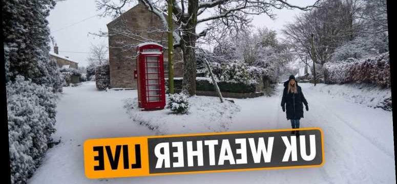
SNOW has begun falling across the country amid Met Office warnings of ice and disruption to travel.
Areas including London, Wales, and the Southwest have seen snow this morning, with temperatures set to fall as low as zero over the course of the day.
The Met Office has said that some areas will see frost and that ice is likely on untreated roads and walkways.
It comes as more than 100 flood warnings and alerts remain in place across England after Storm Christoph.
The storm bought heavy rains and rising river levels to much of the country, causing widespread disruption last week and over the weekend.
The remaining warnings are clustered in Yorkshire, the East, the Midlands, and along the England-Wales border.
Follow our weather live blog below for the latest news and updates from around the country
- Christy Cooney
IN PICTURES – AN AERIAL VIEW OF HOMES IN BRISTOL AFTER SNOWFALL OVERNIGHT

- Christy Cooney
54 FLOOD WARNINGS STILL IN PLACE ACROSS ENGLAND
Fifty-four flood warnings remain in place across England following Storm Christoph.
The storm bought heavy rains and rising river levels to much of the country, causing widespread disruption last week and over the weekend.
The remaining warnings are clustered in Yorkshire, the East, the Midlands, and along the England-Wales border.
A flood warning indicates that flooding is expected.
Full details on the Environment Agency website.
- Christy Cooney
SNOW AND ICEWARNINGS FOR SCOTLAND AND NI
Yellow weather warnings are current in place in western Scotland and Northern Ireland.
The Met Office said that snow was expected in both regions and that icy patches were likely on untreated roads and pathways.
It added that some travel disruption was likely.
The warnings are set to remain in place until at least 11am in Scotland and 3pm in Northern Ireland.

- Christy Cooney
WARNINGS ACROSS SOUTH AND MIDLANDS
Yellow weather warning are in place across the south and east of England as well as the Midlands and Wales.
The Met Office said snow was expected to bring travel disruption and that some rural communities could become cut off.
It also said that rain in the southeast and southwest could lead to ice, particularly on untreated roads and pathways.
The warnings are set to remain in place throughout the day.
- Christy Cooney
SLEET AND SNOW TO MOVE ACROSS COUNTRY
A wave of sleet and snow is set to move across the country over the course of today.
A forecast from the Met Office said it would mainly affect southwest England, Wales, and southeast Northern Ireland at the start of the day, the move east over the Midlands, south, and southeast of England.
It added that there would be sunny spells broken by wintry showers.
- Joseph Gamp
MET OFFICE: SNOW AND ICE TO START SUNDAY MORNING
- Joseph Gamp
MET OFFICE CHIEF FORECASTER SAYS WET WEATHER LIKELY TO RETURN NEXT WEEK
Chris Tubbs, deputy chief forecaster at the Met Office, said wet weather is likely to return from the middle of next week.
He said: "Once the certainty increases about which areas are most likely to be affected by potentially heavy rain, we may need to issue further warnings, especially if next week's rainfall is likely to compound the impacts from this week."
- Joseph Gamp
SPANISH TOURISM MINISTER WANTS BRITS TO RETURN THIS SUMMER
Spain will be open to Brits this summer and wants holidaymakers to start returning within weeks, its tourism minister has said.
Reyes Maroto appeared to contradict Spain’s Prime Minister Pedro Sanchez, who said it wouldn’t be until 70 per cent of the population was vaccinated, around Autumn, that tourists would be allowed.
Read more here.
- Elizabeth Little
HAZARDOUS CONDITIONS EXPECTED
Weather conditions are expected to become more hazardous heading into the final week of January, as the Met Office gets ready to put in place five new weather warnings for snow and ice.
Further heavy rainfall in the wake of Storm Christoph is not forecast until Wednesday – but plummeting temperatures are predicted.
The Met Office said a band of snow will move into south-west England and Wales in the early hours of Sunday morning, spreading to the east Midlands and south-east England later in the day.
Temperatures across the whole of the UK are expected to drop below freezing overnight, with the coldest temperatures in the Scottish Highlands at an icy -10C.
- Elizabeth Little
ONE OF THE COLDEST WINTER NIGHTS SO FAR
- Joseph Gamp
MINUS TEMPERATURES EXPECTED ACROSS THE UK TONIGHT
Saturday night will be very cold in many places across the UK – with temperatures expected to plunge to -10C in the Scottish Highlands in the early hours of Sunday morning.
Elsewhere, London and Manchester are predicted to get down to -3C overnight and Bristol, Belfast and Glasgow will drop to -2C.
As of Saturday evening, five snow and ice warnings were issued for central and southern England, most of Wales, much of Northern Ireland, and western and northern parts of Scotland.
The Met Office said a band of snow will move into South West England and Wales in the early hours of Sunday morning, spreading to the East Midlands and South East England later in the day.
- Joseph Gamp
FLOOD DEVASTATED TOWN TWICE IN A YEAR
Homes in a town previously ravaged by flooding last year have been left devastated, after defence barriers were breached.
Bewdley in Worcestershire saw its temporary flood barrier overwhelmed overnight – less than 12 months after residents experiences severe flooding last February.
Fire and rescue services have been out in boats helping people stuck in their properties.
The Environment Agency (EA) said there had been “exceptionally high river levels” following days of heavy rainfall in the wake of Storm Christoph.
- Joseph Gamp
FOUR YELLOW WARNINGS FOR SNOW AND ICE IN PLACE ON SUNDAY
- Joseph Gamp
IN PICTURES: STREETS TURN INTO RIVERS IN WARRINGTON, CHESHIRE
- Joseph Gamp
WORCESTER 'AT-RISK' RESIDENTS BEING RE-HOMED BY CITY COUNCIL
In Worcester, at-risk householders are being contacted by the city council and offered rest-centre accommodation.
Care home residents were among those evacuated in several areas across the North West, while, in Wales, a helicopter crew rescued a family trapped in their home due to fast-flowing floodwater.
River levels around Ironbridge in Shropshire were expected to peak at around 6.8m overnight.


- Joseph Gamp
WATCH: WEATHER FORECAST FOR SUNDAY, JANUARY 24
UK weather forecast for Sunday 24 January – Cold with wintery showers
- Joseph Gamp
SUN DRAWS HUGE CROWDS TO TYNESIDE BEACHES
While snow fell across much of the country today, the sun drew huge crowds to the North Tyneside coast to enjoy its picturesque beaches.
Longsands, in Tynemouth, was packed to the rafters with dog walkers and families and nearby car parks were almost full.
Groups gathered on the beach for a midday stroll at high-tide, while others took their exercise along the promenade. It was so busy some appeared to observe social distancing rules.
An onlooker said: “Such scenes are quite upsetting to see after last night’s announcement. There’s a new deadly strain of the virus currently spreading, yet people don’t seem to be taking any heed to the guidance.”
- Joseph Gamp
HOW TO KEEP YOUR HOME WARM IN WINTER
It’s vital Brits keep their home warm in winter to avoid health problems.
The cold weather can thicken blood, increasing blood pressure and breathing in cold air can increase the risk of chest infections.
Here’s how you can keep the heat in:
- Fit draught proofing to seal any gaps around windows and doors
- Heat your home to the temperature of at least 18C
- Make sure your loft has 10-11inches of insulation.
- If you have wall cavities, make sure they’re insulted
- Insulate your hot water cylinder and pipes
- Draw curtains at dusk to keep heat in
- Make sure your radiators are not obstructed by curtains or furniture
SATURDAY NIGHT FREEZE
Saturday night will be very cold in many places across the UK – with temperatures expected to plunge to -10C in the Scottish Highlands in the early hours of Sunday morning.
Elsewhere, London and Manchester are predicted to get down to -3C overnight and Bristol, Belfast and Glasgow will drop to -2C.
As of Saturday evening, five snow and ice warnings were issued for central and southern England, most of Wales, much of Northern Ireland, and western and northern parts of Scotland.
The Met Office said a band of snow will move into South West England and Wales in the early hours of Sunday morning, spreading to the East Midlands and South East England later in the day.
MET OFFICE ISSUE ICE WARNING
RAIN TURNS TO SNOW
Residents in the small North Warwickshire village of New Arley woke up to cold and snow this morning as rain turned to snow overnight.
- Elizabeth Little
FLOOD DEVASTATED TOWN TWICE IN A YEAR
Homes in a town previously ravaged by flooding last year have been left devastated, after defence barriers were breached.
Bewdley in Worcestershire saw its temporary flood barrier overwhelmed overnight – less than 12 months after residents experiences severe flooding last February.
Fire and rescue services have been out in boats helping people stuck in their properties.
The Environment Agency (EA) said there had been "exceptionally high river levels" following days of heavy rainfall in the wake of Storm Christoph.
- Elizabeth Little
FLOOD WARNINGS FOLLOWING STORM CHRISTOPH
Brits have been urged to heed flood warnings this weekend, with the Environment Secretary warning of the possibility of more "challenges" in parts of England due to wet weather next week.
The Environment Agency warned of "exceptionally high river levels" following days of heavy rainfall in the wake of Storm Christoph, with hundreds of properties across the country flooded.
Residents in some areas along the River Severn have been advised there could be flooding on Saturday, with some levels peaking at heights similar to the February washout last year.
In Worcester, at-risk householders are being contacted by the city council and offered rest-centre accommodation.
Care home residents were among those evacuated in several areas across the North West, while, in Wales, a helicopter crew rescued a family trapped in their home due to fast-flowing floodwater.
- Elizabeth Little
-2C EXPECTED ON SUNDAY
Weather charts show temperatures plummeting to -2C in London and much of the South East on Sunday.
Met Office chief forecaster Steve Willington said cold air from Iceland and the Arctic will bring with it "a mix of wintry hazards across the UK".
He said: "In clearer conditions, overnight ice will remain a hazard, while a band of snow is likely to bring falls of 1-3cm quite widely across central areas of the UK, particularly the Cotswolds and higher ground in the East Midlands on Sunday.
"But snow outside these areas is also a potential hazard."
- Elizabeth Little
SNOW BLIZARDS REPLACE STORM CHRISTOPH
Storm Christoph is to be replaced by snow blizzards across the UK as more flooding is forecast in the days ahead.
Low temperatures are set to bring snow and ice across much of the UK with a -10C big freeze set to take hold before more rain arrives next week.
A Yellow weather warning will be in place today in Scotland while another three warnings for snow and ice will be issued starting tomorrow for the south of England.
According to the Met Office, the cold snap this weekend could bring up to 10cm of snow to hard-hit areas, with travel disruption expected.
Source: Read Full Article
