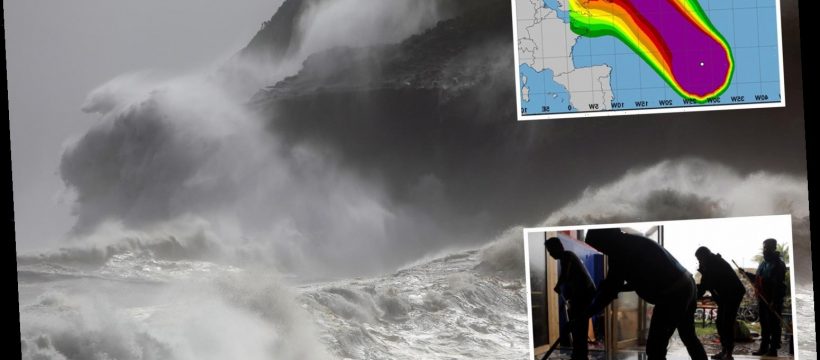
HURRICANE Lorenzo is sent to clobber Britain and Ireland with 90mph gales, 18ft waves and surging floods from tonight.
The colossal 500 mile-wide storm — dubbed a “real beast” by the Met Office — has been dramatically laid bare on weather maps.


This evening will see gusts of up to 90mph in Ireland's west and 60mph in Northern Ireland, with 65mph gusts battering England's South-West tomorrow.
Other parts will be blustery today.
Lorenzo's waves, which reached 70ft near the Azores, are due to reach 32ft just off the coast of Ireland, and 18ft England's South-West coasts and western Scotland's coasts, a magicseaweed map showed.
Downpours will hit most.
The Environment Agency said: “Flooding from surface water and rivers is possible across Wales, the Midlands and North. Coastal or tidal flooding is possible on coasts of south Wales and south-west England.”
HURRICANE FORCE WINDS
Met Office forecaster Marco Petagna said: “Lorenzo could approach Ireland with hurricane-force winds.
“Gusts of 80mph or more are suggested on Ireland's west coast, 65mph on England's south-west coasts, and 60 mph on Northern Ireland's coasts.
“Warnings have been issued so people should stay weather-aware.”
A Met Office forecaster added: “Lorenzo will also bring a spell of heavy rain to much of the UK mainly on Thursday night and into Friday.
“Keep an eye out for any warnings which may be issued in your area.”

Met Office forecaster Steven Keates earlier said: “Lorenzo is a real beast of a storm.”
Lorenzo, which was a maximum Category 5 storm before hitting the Azores, is the strongest hurricane ever recorded so close to Europe.
The Met Office said: “The National Hurricane Center has confirmed Hurricane Lorenzo is the strongest on record this far north and east in the Atlantic.”
Winter's first snow hit Scotland on Tuesday, with a covering on Cairngorm, Highland as polar winds blew in.
Snow expert and author Iain Cameron said: “We've had the first fresh snowfall of the season.”


Source: Read Full Article