STORM Brendan has caused chaos across the country over the last 48 hours, with huge 50ft waves and gusts of more than 80mph leaving thousands without power and ripping the roof of a building.
The Met Office has warned there is more rain and wind to come. Where is Storm Brendan now?

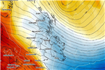
Where is Storm Brendan now?
Stormy weather conditions which disrupted flights and damaged homes are due to ease on Wednesday, before another spell of wind and rain hits the UK.
The Met Office has removed the yellow weather warning on Wednesday, January 15, after gale-force winds and torrential downpours closed roads and ripped off roofs. flooding and power cuts.
The eye of Storm Brendan swept through Britain on Monday, the strongest gust of 87mph recorded in the western Isles.
A second low-pressure front brought further strong gales to much of the country on Tuesday, ripping off the roof of an apartment block housing 200 people in Berkshire.
The Met Office recorded gusts were in excess of 50mph at the time of the incident.
Storm Brendan has now cleared the UK but a new weather front bringing heavy rain is on the way for Thursday.
How can I track Storm Brendan?
The Met Office Storm Centre website provides all the information you need to track storms battering the country.
You can also check for updates on the Met Office app.
Another tracking tool used to keep tabs on storms and weather systems is Ventusky, or you can use Windy.com.

What's the latest weather forecast?
Although destructive winds are due to ease slightly on Wednesday, gusty conditions are expected to continue with temperatures dropping to 9 degrees.
More unsettled weather is warned for Thursday, particularly during the second half of the day, when the country can expect wet and windy weather.
Commuters across the country are expected to experience longer travel journeys, with more wild weather continuing across England and Wales.
Storm Brendan is set to be followed with icy patches, winter showers and more wind gales in parts of Scotland, which could lead to further travel disruption.

Wednesday
Rain and winds are expected to somewhat ease in the south-west.
Showers are due in the west, with risk of rain and thunder in west Scotland.
The weather will become wilder during the night, with outbreaks of rain spreading to Northern Ireland and western Scotland around dawn.
The day will start dry and windy before skies give way to another batch of wet and very windy weather, especially across England and Wales.
Showers and strong winds are expected throughout the night in northwest Scotland and parts of Northern Ireland.
Maximum temperature 9C, but the wind and rain will make it feel unpleasant.
There are flood warnings across England, Scotland and Wales.

Thursday
Wind and rain expected to spread quickly across Northern Ireland and Scotland, before moving across England and Wales.
Rain locally heavy in the west with coastal gales.
Maximum temperature of 13C
Friday
Sunny spells are expected on Friday, with continued showers becoming heavy at times.
The lead into the weekend is expected to be chilly, with frost and fog patches across the country.
Maximum temperature of 10C.
How did Storm Brendan get its name?
UK storms are named in advance so people can take notice of warnings.
The Met Office has followed the US system of giving girls and boys' names to tropical storms and hurricanes.
A total of 21 names were chosen by Met Office – whittled down from a total of more than 10,000 suggestions submitted by the public.
One name was picked for each letter of the alphabet, apart from Q, U, X, Y and Z.
Every major storm will be named according to the list, ordered alphabetically.
LATEST WEATHER
SNOWMAGEDDON
Arctic blast to batter New Jersey, Virginia, Texas, & other states THIS WEEK

Warning as Arctic blast hits Texas a year after hundreds died in winter storm

Mercury plunges to -4C today – with coldest night of winter to hit TOMORROW

Coldest night of winter to hit TOMORROW with -5C Arctic blast on its way
What's the worst storm in UK history?
The Great Storm of 1987 is classed as the worst storm in UK history.
It made landfall in Cornwall on October 15, and pushed eastwards with gusts of up to 120mph.
Around 15 million trees fell over much of England, and destroyed historic specimens in the likes of Kew Gardens and Wakehurst place.
Rails and roads were blocked, and the windows and roofs of houses were almost destroyed.
Several hundred people were left without power for around two weeks.
Source: Read Full Article