THE Met Office has warned of plunging temperatures and even snow over the coming weeks.
Mercury could drop as low as -3C in parts of Britain in February in what could well be the final sustained Arctic Blast to hit the country before Spring.
There's even the threat of "blizzard conditions" in parts of Scotland, with the Met Office predicting Dalwhinnie will see the worst of the wild conditions.
Short term, though, most southern parts are set to be dry, with frequent showers across northern parts later tonight.
Wales and central England are also expected to see rain.
Read our weather live blog for the latest news and forecasts…
- John Hall
Have we been having more storms in the past few years?
While we haven't been experiencing more storms, we have been experiencing more severe storms.
According to the Met Office, the period from mid-December 2013 to Mid-February 2014 was the stormiest period of weather for the UK for 20 years.
Stormy weather is not uncommon or unusual in the winter, but with increased severity, they may cause more widespread impacts.
- John Hall
The warm years continue – 2022 set to be another of the warmest years
2022 is set to be the eighth year in a row with temperatures exceeding pre-industrial levels.
It is likely to be one of the coolest since 2015, but still relatively warm.
We should expect a somewhat wet Summer ahead.
- John Hall
Rainy spells tonight and tomorrow, but pretty mild
Most southern parts set to be dry, with frequent showers across northern parts later tonight. Ales and central England are also expected to see rain.
Tomorrow looks to be dry and mild across most of the UK.
Though, it is likely to be wet and windy across the north
- John Hall
No severe weather in UK caused by melting ice caps
A recent study by the Met Office shows that while the ice caps in the Arctic Sea continue to melt, they're unlikely to cause severe weather in the UK.
It says the melting is unlikely to outweigh the warming effects cause by greenhouse gases so the UK is unlikely to experience any severe weather caused by it.
So, get your brollies out ready for milder and wetter winters in the future.
- John Hall
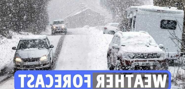
Britain to be blanketed in 17 INCHES of snow next week
The snowy snap is set to strike the day after Valentine’s Day, with parts of Northern England and Scotland predicted to be hit the worst.
According to WX Charts, Scots could see as much as 16.9 inches of snow piling up outside their front doors.
Towards the end of this week, Manchester and Edinburgh could also see around two centimetres of snow, forecasters said.
And in the Midlands, Birmingham could see a smattering of flakes too – around one centimetre, on Friday.
According to the Met Office, next week will also see wintry showers, sunshine and dry patches.
- John Hall
Four possible flood warnings in the UK from the Met Office
Severn, Trent, Upper Derwent and Severn Vyrnwy confluence may experience flooding due to the increased water levels.
Shropshire, Derbyshire, Cumbria and Powys at risk.
It's advised that roads near these bodies of water are avoided if possible.
- The Sun
Dry London – forecast for the next week, not a brand of gin
London is set to be mild for the next week with a highs of 12 degrees tomorrow, and not dropping to freezing at all.
Chances of brief rain here and there, but mainly mild, dry weather for the next seven days in the capital.
Nice weather for a winter stroll; perhaps something to bear in mind with Valentine's Day right around the corner…
- John Hall
Forecast for 11-20 February
On Friday, wintry showers likely to affect northern areas, becoming lighter and less frequent through the day, while elsewhere expected to be dry with plenty of sunshine.
Windy in the north initially, elsewhere likely much lighter than previous days. Heavy rain may return to the northwest and windy for most, with gales possible in the west and northwest at the weekend.
Through the rest of this period high pressure will likely dominate across most of the UK.
Rainfall will be limited at first with a risk of some wintry showers in the north and east, with an increasing chance of rain in western and northwestern areas later.
Temperatures likely to be near average with the potential for a brief colder interlude for northern and eastern parts.
- John Hall
February 14-28 weather outlook
The current north-south split to the weather is likely to continue from mid-February and through to the second half of the month.
Northern areas, especially the northwest, are likely to see nearer average temperatures with more rain and strong winds interspersed with a few short-lived colder spells.
Southern regions are likely to see warmer, drier and overall, more settled conditions.
- John Hall
How can winter weather damage your health?
The Met Office says: “Cold temperatures have an impact on our health, but there are other risks in winter including physical injuries from slips, trips and falls.
“As we get older it becomes harder for our bodies to detect how cold we are, and it takes longer to warm up which can be bad for our health.
“For older people in particular, the longer the exposure to the cold, the more risk of heart attacks, strokes, pneumonia, depression, worsening arthritis and increased accidents at home (associated with loss of strength and dexterity in the hands).”
- John Hall
UK weather outlook for Tuesday and Wednesday
Tuesday will bring another cloudy day with spells of rain across northern and western areas which may be locally heavy. Brighter spells will develop at times too.
Wednesday will be cloudy with rain across northern Britain which may fall as snow across parts of Scotland, especially over high ground.
- John Hall
Temperatures set to drop in many parts of country
Temperatures are set to plummet to a frosty -3C in Loch Rannoch as alarm clocks sound at 6am on Monday morning, while most other areas will struggle to hit above 5C before 9am.
In Camborne, Cornwall, however, the Met Office predicts temperatures staying around the 8C mark overnight.
According to the Met Office, many northwestern areas can expect rain during the week before colder conditions and wintry showers hit regions across the country on Thursday.
It comes as the agency has today forecast a bitter -6C cold snap and more snow.
- John Hall
How to stay warm in bed during winter
With the frosty winter weather, it’s no surprise many of us are spending more time in bed to avoid the big chill.
UK-based Georgia Metcalfe, co-founder and creative director of The French Bedroom Company has come to the rescue and provided five tips that will keep you toasty throughout the next few cold months.
According to the sleep expert, the best temperature to help you nod off is around 18°C – and this can be achieved in the colder months by turning up the duvet tog.
“Choose a higher tog duvet of at least 13 which will retain as much heat as possible,” she explains.
“It will allow you to stay snuggly throughout the colder months, and you will never want to leave your boudoir as it keeps you wonderfully cosy.”
“If you want an added layer, place a velvet bedspread on top of your bed linen, or for something more luxurious, try cashmere.”
She went on to note that it’s easy to feel lethargic when the alarm goes off on a cold morning, but says you will feel more comfortable by changing the materials in your bed such as altering your bedwear to silk pyjamas and putting on a pair of soft socks as this will help you feel warmer, improving your sleep in the process.
- John Hall
Bookies odds on snow
Forecasters are warning of two months of freezing temperatures and snow.
It is odds on at 4-5 with bookmaker Coral that this month goes on to become the coldest February in the UK since records began.
Coral’s Harry Aitkenhead said: “We make this month odds on to enter the history books as the coldest February we have ever recorded, with snow and freezing temperatures set to become the norm for the rest of winter.”
- John Hall
Top tip: Keep an emergency winter kit in your car
No driver plans to break down but it happens and often at the most inconvenient times.
It’s best to keep an emergency kit in the car just in case, especially if it’s dark out and temperatures have plummeted.
It’s also worth keeping de-icer in the pack so you have some ready for those frosty mornings.
Hugo said: “A torch, a first-aid kit and some emergency food and drink may also come in handy, while keeping de-icer and a decent scraper in the car will make frosty morning starts less wearisome.”
Source: Read Full Article