BRITAIN'S Arctic freeze will see up to 11 inches of snow hit today – with further warnings for rain and ice in place across the country.
An amber “potential risk to life” weather alert, in place from 3am to 1pm on Tuesday – will cover Bradford, Leeds, Wakefield, Sheffield, Huddersfield, Harrogate and the surrounding areas.
Travel delays on roads are likely, stranding some vehicles and passengers and there is a chance of delays and cancellations to rail and air travel.
Yellow weather warnings are also in place for rain, snow and ice for a large part of northern England – with the huge area covers Nottingham in the midlands all the way up to Dundee in Scotland.
Follow our weather live blog below for the latest news and updates from around the country
- Chiara Fiorillo
YELLOW WARNINGS FOR RAIN, SNOW AND ICE
Yellow weather warnings are in place for rain, snow and ice for a large part of northern England.
The huge area covers Nottingham in the midlands all the way up to Dundee in Scotland.
This warning began at 10pm on Monday and will last until the end of today.
- Chiara Fiorillo
AMBER SNOW WARNING
A rare amber snow warning with “potential risk to life” has been issued by the Met Office as heavy snow blankets Britain today.
Parts of England will be hit with up to 15cm of white stuff amid fears that communities could become “cut off” – with travel chaos expected.
The weather alert which began at 3am this morning and lasts until 12pm will cover Bradford, Leeds, Wakefield, Sheffield, Huddersfield, Harrogate and the surrounding areas.
Between 3cm and 8cm of snow is likely across the area, with 10cm to 15cm possible in areas above 200 metres.
- Chiara Fiorillo
EVER HEARD OF ICE PANCAKES?
Ice pancakes are a phenomenon where discs of ice anywhere from 20 – 200 cm wide are formed creating a unique spectacle.
They are most frequently seen in the Baltic Sea and around Antarctica but also form relatively frequently on the Great Lakes of the United States and Canada.
Whilst ice pancakes look like solid discs, they are often quite slushy and easily break apart when lifted up, according to the Met Office.
- Chiara Fiorillo
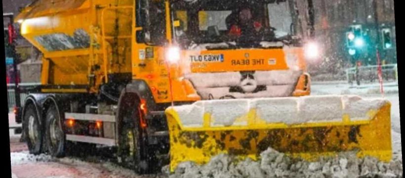
HEAVY SNOWFALL
Heavy snowfall started in the village of Leadgate in County Durham this morning.
Pictured is a resident trying to make her way to work.

Credit: North News and Pictures - Chiara Fiorillo
FREEZING TEMPERATURES
Temperature maps from the weather agency showed the mercury plunging to -15C in rural areas of Northern Scotland, and as low as -6C in the North of England on Saturday night.
The lowest temperature recorded before this was -13C in Dawyck Royal Botanic Gardens in the Scottish Borders, the Met Office said.
- Chiara Fiorillo
COLD WEATHER TO CONTINUE THIS WEEK
Met Office forecaster Simon Partridge said the wintry weather will continue into this week.
He predicted a "much heavier" band of rain to arrive overnight on Monday into Tuesday which will "quickly turn to snow as it bumps up against cold air".
- Chiara Fiorillo
TAKE CARE IN THE SNOW
- Katie Davis
TODAY'S FORECAST
Heavy snow will affect parts of northern England and southern Scotland, mostly turning to rain in northern England.
It will be brighter and very mild further south, with bands of heavy showers.
There will be wintry showers far north.
- Katie Davis
RAIN TO CLEAR FOR A DRY NIGHT
Rain expected to settle in for the afternoon over much of the UK will likely clear for a dryer night.
"Mostly light rain in the evening will move away eastwards to leave the rest of the night dry but largely cloudy," Met Office said.
Winds would likely ease, and minimum temperatures would hover around 3C.

- Ben Hill
FIRE DOWN UNDER
Firefighters in Western Australia battled gusty winds and high temperatures on Tuesday as they fought a bushfire that has scorched thousands of hectares of land, raging out of control to ravage more than 30 homes.
Television broadcast images of air tankers, laden with thousands of litres of water or fire retardant, flying over the flames, spread across more than 7,000 hectares (17,300 acres), about 40 km (25 miles) from the state capital of Perth.
"Right now, Western Australia is battling two different kinds of emergencies – a dangerous fire emergency and a Covid-19 lockdown emergency," said its premier, Mark McGowan.
- Ben Hill
CARS STUCK
Overnight, vehicles became stuck on the eastbound M62 near Rochdale, Lancashire, between junction 21 for Milnrow and junction 22 for Denshaw leading to a temporary closure of the carriageway, and a lorry jack-knifed on the same motorway westbound between junction 23 and junction 22 in the early hours.
Forecasters said motorists who brave the roads are at risk of becoming stranded, while rail and air cancellations are likely.
Power cuts and disruption to mobile phone coverage are also expected, while rural communities face being cut off completely.
- Ben Hill
HEAVY SNOW OVERNIGHT
Parts of northern England have seen heavy snowfall overnight, with the Met Office warning rural communities are at risk of becoming cut off and widespread travel disruption is likely.
An amber weather warning for snow came in force across much of South Yorkshire, and parts of Derbyshire, West Yorkshire and Greater Manchester at 3am on Tuesday and will last until 1pm.
Between 3cm and 8cm of snow is likely across the area, with 10cm to 15cm possible in areas above 200 metres.
- Joseph Gamp
YELLOW SNOW AND ICE WARNINGS ALSO IN PLACE FOR NORTHERN ENGLAND AND SCOTLAND
The UK was battered with torrential rain over the weekend leaving cars submerged on flooded roads across the country.
Yellow weather warnings are also in place for rain, snow and ice for a large part of northern England.
The huge area covers Nottingham in the midlands all the way up to Dundee in Scotland.
This warning is in place from 10pm Monday until midnight on Tuesday.
- Joseph Gamp
BREAKING: AMBER ALERT FOR PARTS OF NORTHERN ENGLAND AS HEAVY SNOW FORECAST
Parts of northern England can expect heavy snowfall overnight, the Met Office has said, with rural communities at risk of becoming cut off and widespread travel disruption likely.
An amber weather warning for snow is in force across much of South Yorkshire, and parts of Derbyshire, West Yorkshire and Greater Manchester from 3am on Tuesday until 1pm.
Between 3cm and 8cm of snow is likely across the area, with 10cm to 15cm possible in areas above 200 metres.
Forecasters said motorists who brave the roads are at risk of becoming stranded, while rail and air cancellations are likely.
Power cuts and disruption to mobile phone coverage are also expected, while rural communities face being cut off completely.
- Joseph Gamp
RAIN WILL TURN INTO SNOW IN NORTH OF THE UK – MET OFFICE
Frank Saunders, Met Office chief meteorologist, said: “Rain will push into the southwest of the UK on Monday evening, bringing some heavy rain for southern areas.
“As the weather front ‘bumps’ into colder air further north, the rain will turn to snow, and with up to 4cm falling quite widely a snow and ice warning has been issued.”
Mr Saunders said between 5cm and 10cm of snow could fall over higher ground in southern Scotland and northern England early this week, with the possibility of 20cm or more across the highest roads.
It is a much milder picture further south, with temperatures hitting 10C (50F) in Cornwall on Monday compared with lows of minus 7C (19.4F) in northern Scotland.
- Joseph Gamp
WEATHER FORECAST FOR MONDAY 2 FEBRUARY: WARNINGS FOR SNOW AND ICE
UK weather forecast for Monday 1st February – Warnings for snow and ice
- Joseph Gamp
YELLOW SNOW AND ICE WARNINGS FOR TUESDAY
The Met Office says “snow, with a risk of widespread ice, is likely to push slowly northeast during Tuesday, bringing difficult travel conditions.”
This could cause serious travel delays and some rural communities in the UK becoming cut off.
Power cuts may occur and other services, such as mobile phone coverage, might be affected by the weather.
There is also the risk of injury from slips and falls – so, it is best to be careful when walking and driving.
- Joseph Gamp
SNOW ON THE WAY IN SCOTLAND AND MORE FLOOD MISERY FURTHER SOUTH
The UK will see a north-south divide this week with northern parts facing days of treacherous wet and icy conditions, with temperatures much higher further south.
There are a series of yellow weather warnings in place throughout the week, with central and northern Scotland in particular expected to see sub-zero conditions and patches of snow.
Elsewhere there is a yellow weather warning for rain and snow across County Derry and County Antrim in Northern Ireland in force until midday on Tuesday, meaning some flooding is possible.
An alert for snow and ice is also in place from central Scotland down to the Midlands until midnight on Tuesday, which is likely to affect public transport, and pose a risk of stranding to private vehicles.
A concentrated band of heavy rain running from County Durham through the middle of Yorkshire is due to fall from 6pm on Tuesday until 4am on Wednesday bringing travel delays and localised flooding.
- Joseph Gamp
TUESDAY MORNING JOURNEYS TO BE IMPACTED BY 'DISRUPTIVE SNOW AND ICE'
- Joseph Gamp
RAIN WILL TURN INTO SNOW IN NORTH OF THE UK – MET OFFICE
Frank Saunders, Met Office chief meteorologist, said: "Rain will push into the southwest of the UK on Monday evening, bringing some heavy rain for southern areas.
"As the weather front 'bumps' into colder air further north, the rain will turn to snow, and with up to 4cm falling quite widely a snow and ice warning has been issued."
Mr Saunders said between 5cm and 10cm of snow could fall over higher ground in southern Scotland and northern England early this week, with the possibility of 20cm or more across the highest roads.
It is a much milder picture further south, with temperatures hitting 10C (50F) in Cornwall on Monday compared with lows of minus 7C (19.4F) in northern Scotland.
- Joseph Gamp
57 FLOOD WARNINGS AND 145 ALERTS ACROSS ENGLAND
There are currently 57 flood warnings from the Environment Agency in place across England, with a further 145 flood alerts.
Natural Resources Wales has issued two flood alerts, one for the Carmarthenshire coast and another for south Pembrokeshire.
Jason Kelly, Met Office deputy chief meteorologist, said: "While the south of the UK hangs on to the milder air for much of this week as we approach the weekend, the area of low pressure responsible for the snow across the north of the UK will clear, allowing colder air to push south and west across much of the country.
"Further snow is expected for most parts of Scotland on Friday, while Saturday will be cold for all."
- Joseph Gamp
SNOW ON THE WAY IN SCOTLAND AND MORE FLOOD MISERY FURTHER SOUTH
The UK will see a north-south divide this week with northern parts facing days of treacherous wet and icy conditions, with temperatures much higher further south.
There are a series of yellow weather warnings in place throughout the week, with central and northern Scotland in particular expected to see sub-zero conditions and patches of snow.
Elsewhere there is a yellow weather warning for rain and snow across County Derry and County Antrim in Northern Ireland in force until midday on Tuesday, meaning some flooding is possible.
An alert for snow and ice is also in place from central Scotland down to the Midlands until midnight on Tuesday, which is likely to affect public transport, and pose a risk of stranding to private vehicles.
A concentrated band of heavy rain running from County Durham through the middle of Yorkshire is due to fall from 6pm on Tuesday until 4am on Wednesday bringing travel delays and localised flooding.
- Sarah Grealish
PICTURED: HUGE WAVES IN CORNWALL
Police in Newquay were today forced to close the huge car park at Towan Head Fistral beach after hundreds of spectators arrived to view huge waves being ridden by a powered surfboard rider.
Credit: Alamy Live News - Sarah Grealish
WEATHER WARNINGS
Met Office forecaster Simon Partridge said the wintry weather will continue into this week.
He predicted a "much heavier" band of rain to arrive overnight on Monday into Tuesday which will "quickly turn to snow as it bumps up against cold air".
This has triggered further yellow weather warnings for snow and ice on Tuesday and Wednesday.
Northern England and parts of Wales could see snow "pretty much anywhere", with 1cm to 5cm likely at lower levels and 5cm to 10cm possible in the hills.
- Joseph Gamp
TEMPERATURES TO HIT -11 IN SOME PARTS THIS EVENING

Source: Read Full Article